


Satellite imagery of a shortwave radio transmitter site in Hyangsan county, Jagang province, shows 23 large steel towers spread across four zones. The towers reveal the scale of the infrastructure North Korea still uses in 2026 to beam state propaganda around the world. The site is known as a main transmission hub for Voice of Korea, the regime’s international radio service. Known as Radio Pyongyang until 2002, the station airs programs in English, Chinese, Japanese, Russian, French, Spanish, Arabic and German.
High-resolution images show the towers grouped into four clusters among rivers, farmland and forest. The four zones hold five, five, six and seven towers, respectively. Each tower is a large lattice structure anchored on a square concrete foundation on broad, flat land. I measured their shadows and factored in the sun’s elevation and the season to estimate their height. By that method, the towers stand roughly 20 to 100 meters tall.
The site spreads its towers along riverbanks and farmland, a layout typical of large shortwave broadcasting facilities. Zones 1 and 2 hold relatively tall towers that may handle wide-area transmissions. Zones 3 and 4 feature somewhat shorter towers that follow the contours of the land. The design appears to let operators run different antennas for each frequency band, broadcast direction and target country. Shortwave signals bounce off the upper atmosphere and can travel thousands of kilometers to distant listeners. That reach explains why governments and international broadcasters still rely on shortwave radio today. The Hyangsan facility appears to be a core hub for North Korean propaganda aimed at the international community.
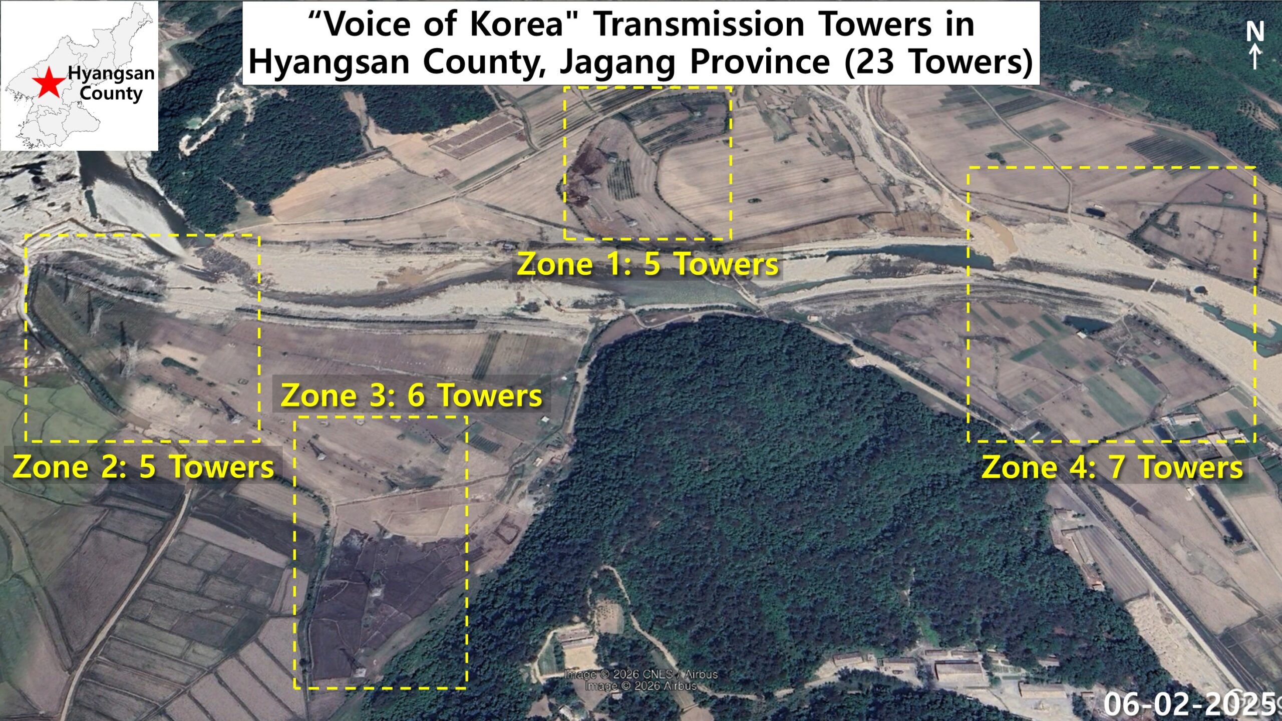
Imagery from June 2, 2025, shows the towers spread along riverbanks and farmland across a wide area. The site measures about 1.2 kilometers from east to west and 745 meters from north to south. Instead of packing the towers into one compound, planners used the wide plain and local terrain to create four zones.
Zone 1, on farmland in the north, and zone 2, along a riverbank to the west, each contain five towers. Zone 3 follows the terrain to their east and holds six towers in total. Zone 4 sits on farmland at the eastern edge of the site and has the most, with seven. This spread may let operators vary antennas by direction, frequency band and target country. It may also help reduce interference between signals broadcast at the same time. The arrangement matches antenna arrays seen at large shortwave broadcasting systems in other countries.
Tower heights vary across the four zones of the Voice of Korea site
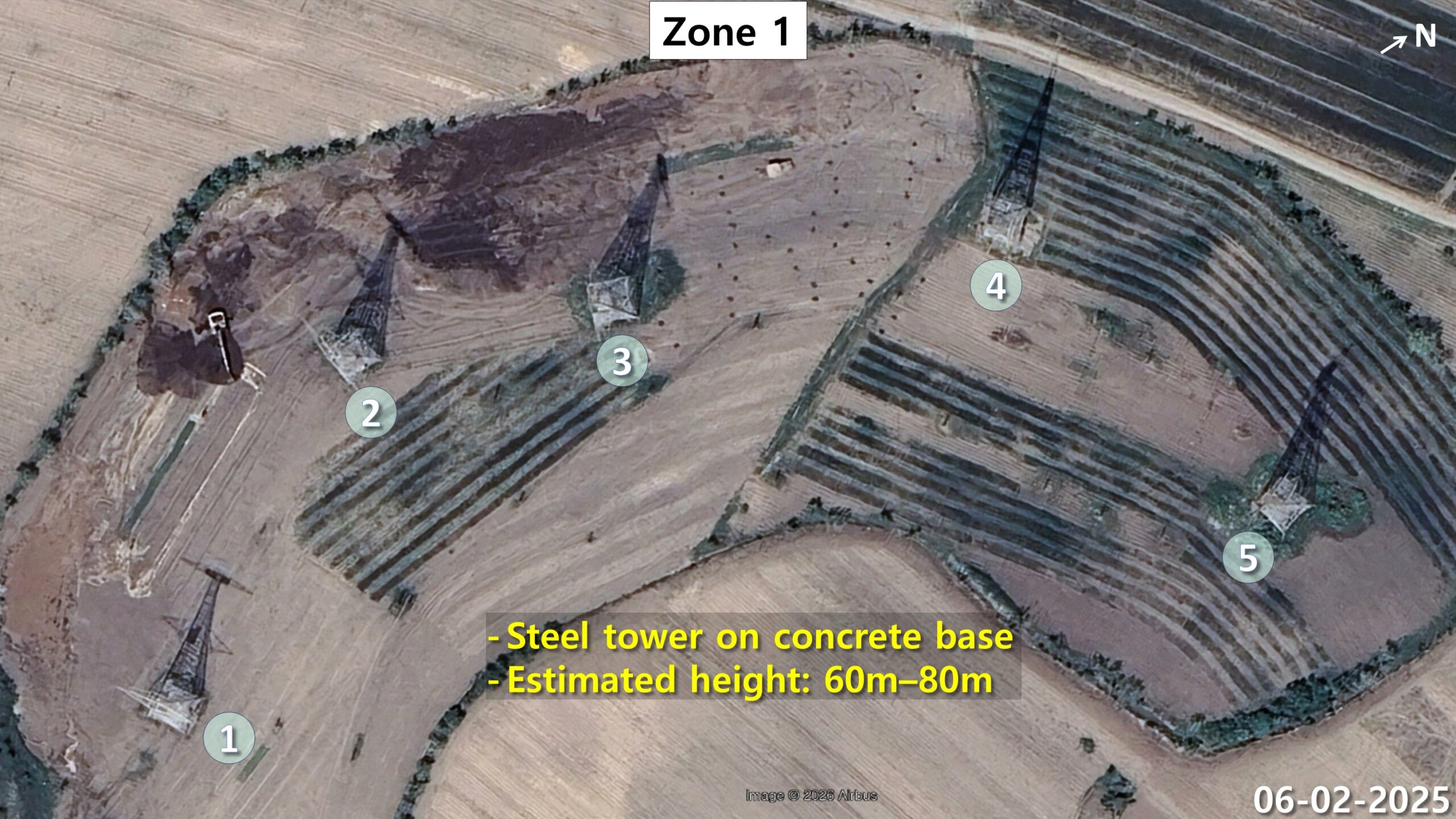
In zone 1, five large lattice towers on square concrete foundations stand at regular intervals. They line the edge where open ground meets farm fields in the northern part of the site. I estimate their height at about 60 to 80 meters, based on shadows, capture time, season and solar elevation. Small maintenance buildings and support facilities are also visible near the towers. The spacing of towers 1 through 5 appears to use the terrain to reduce interference and boost transmission efficiency.
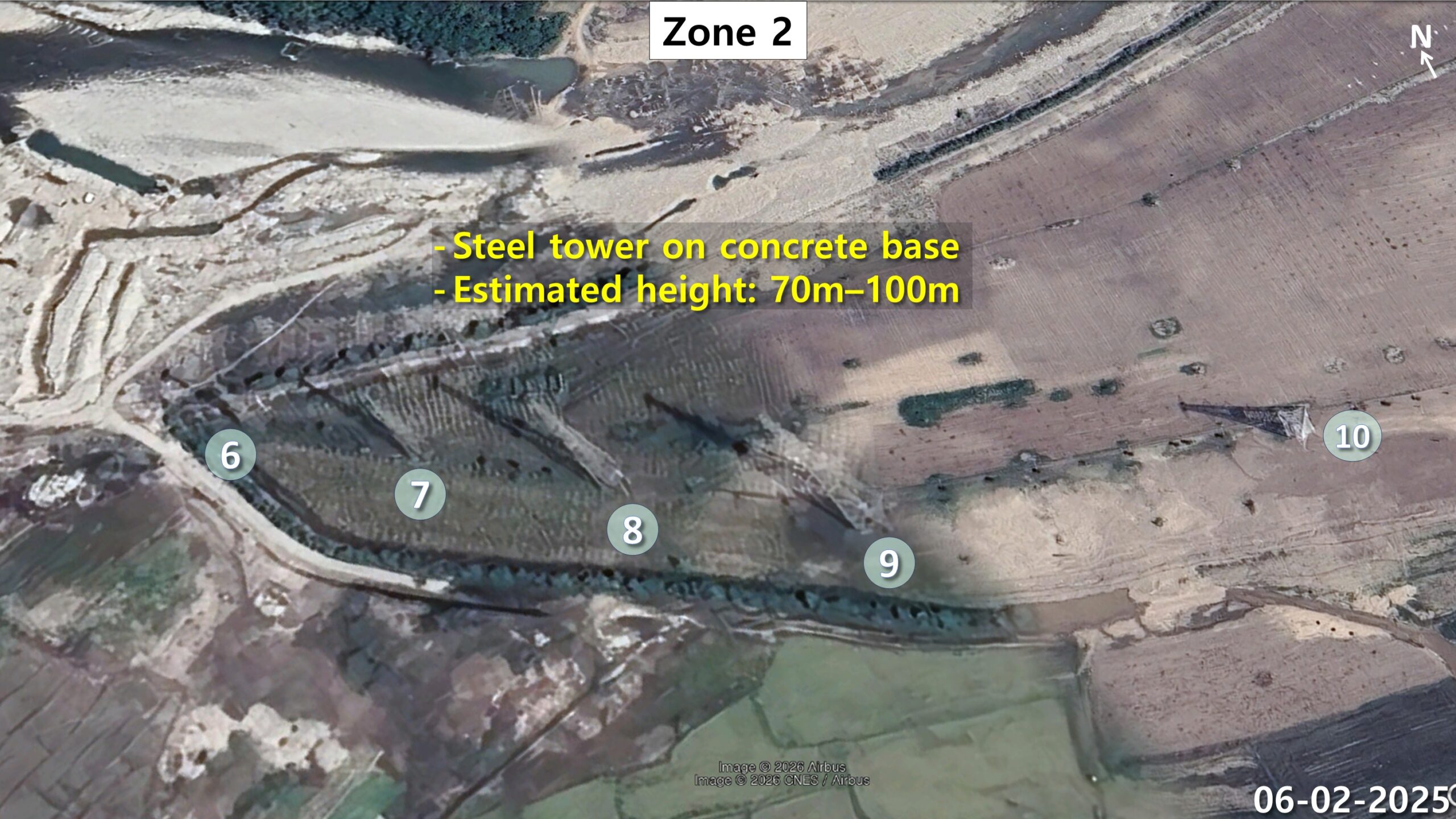
Zone 2 contains five towers, numbered 6 through 10, in a long east-west row. The row crosses the plain where the riverbank meets farmland on the western side of the site. The towers rest on sturdy concrete foundations and appear to be large antenna support structures. Judging from features visible in the imagery, they stand roughly 70 to 100 meters tall. The regular spacing of these tall towers suggests engineers planned the layout around antenna structure and broadcast direction.

In zone 3, six towers numbered 11 through 16 stand at regular intervals among rice paddies and dry fields. They follow the surrounding terrain and the boundaries of the fields around them. Shadow analysis puts their height at about 20 to 30 meters, well below the towers in zones 1 and 2. Varying tower heights along the land’s contours may reflect choices about broadcast direction, antenna design and efficiency. The zone looks like an antenna array built for specific frequency bands and signal directions. However, the exact frequencies and broadcast directions cannot be confirmed from satellite imagery alone.
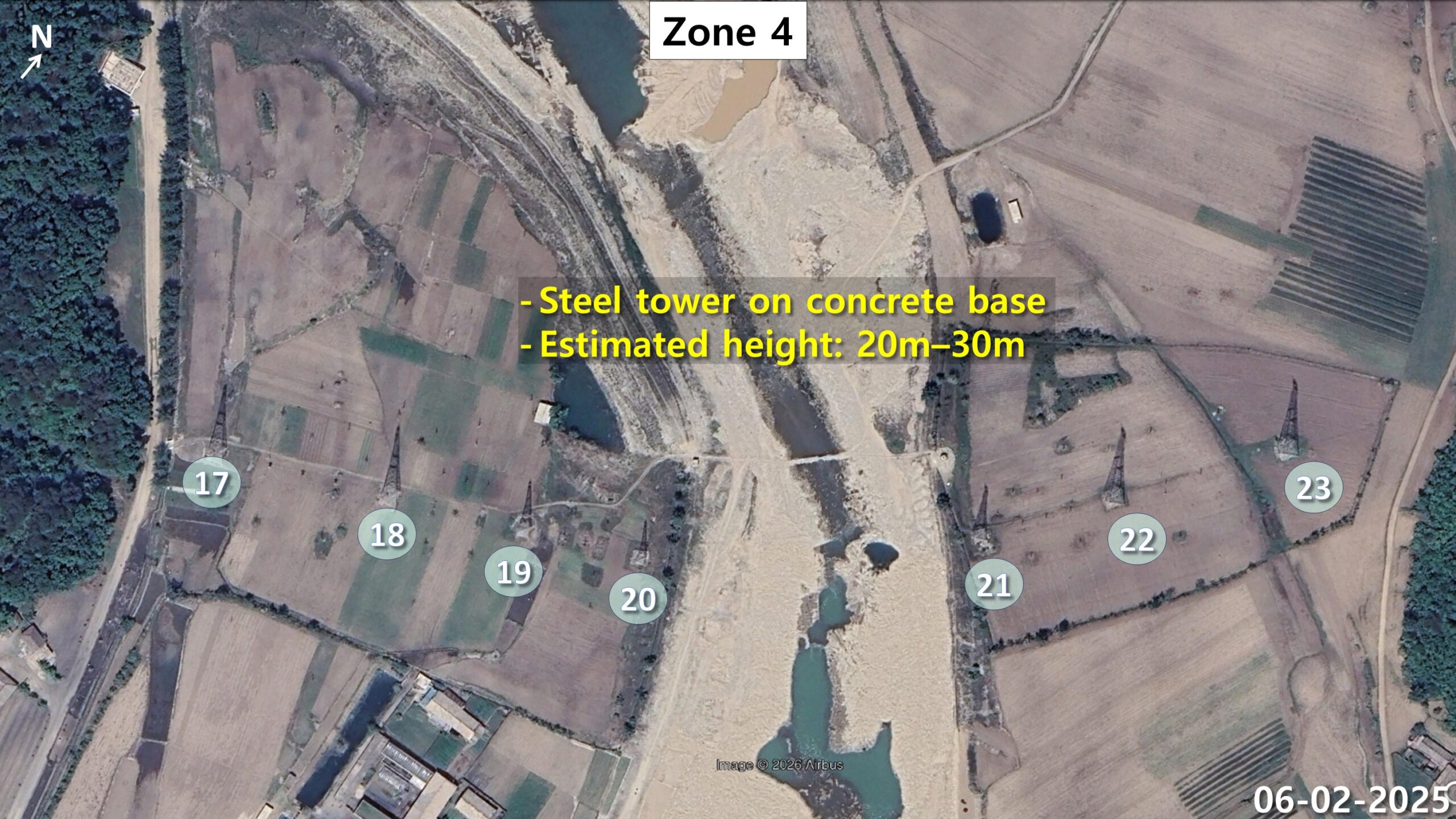
Zone 4 straddles a river that runs through its center, giving the zone a balanced layout. Towers 17 through 20 stand on the western bank, while towers 21 through 23 stand on the eastern bank. These towers also appear to measure about 20 to 30 meters and follow the riverbank and farm plots. Support equipment and maintenance areas that seem linked to broadcasting operations are visible around them.
The size of the Hyangsan site shows how heavily the Kim Jong Un regime invests in projecting its message abroad. At the same time, Pyongyang works hard to stop outside information from reaching its own people. North Korean authorities have long jammed foreign radio broadcasts aimed at the country. Those targets include programs from Unification Media Group, the Seoul-based nonprofit that operates Daily NK. Private broadcasters have reported that the jamming grew stronger after Kim Jong Un came to power. Defectors say listening to outside radio led them to question what North Korean state media told them. This analysis is part of my ongoing satellite imagery series on North Korean infrastructure. The series has also tracked activity at the Pyongsan uranium refinery in North Hwanghae province.
October 26, 2026 at 08:07PM
by DailyNK(North Korean Media)